

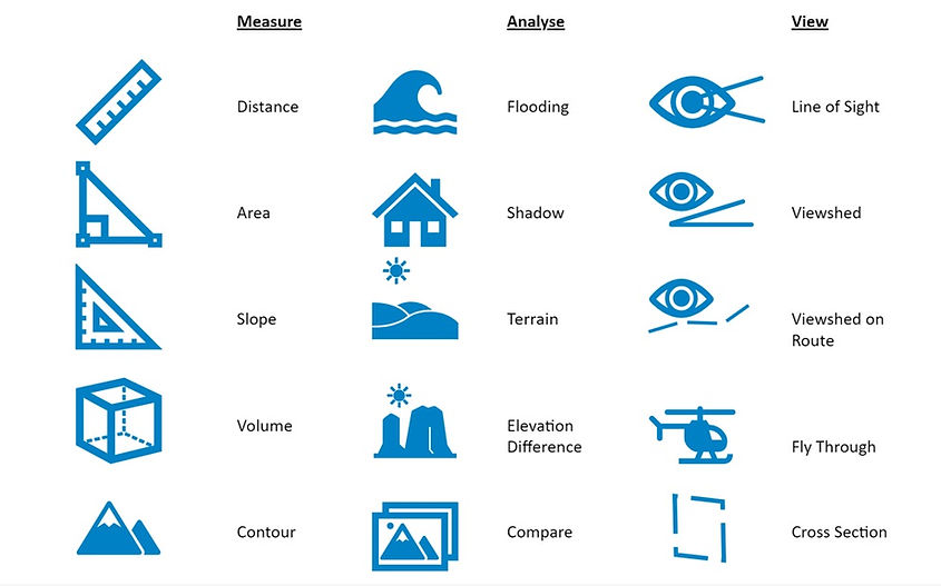
3D Imagery
3D Get There Without Going There
What if you could do a site visit from your desk without losing precious time travelling and without incurring any travel costs. With 3D meshes generated from existing nadir imagery you can do just that. 3D models offer the following benefits over traditional 2D imagery and maps:
Cost Benefit
-
Generate a 3D model from existing Nadir imagery
-
Conduct site inspections from the office eliminating travel costs and time.
-
Extract more value from your capture.
Oblique Views
-
Oblique views instantly provide terrain context you don't get from 2D imagery
-
Oblique views of hill sides, coastlines
for environmental analysis -
Can be generated from historic capture
Typical Applications
-
Environmental monitoring
-
Emergency response
-
Asset inspection
-
Urban planning
-
Infrastructure monitoring
Versatile Data Rich
-
3D layers can be hosted and streamed into all leading GIS platforms
-
Present projects in 3D to increase contextual understanding of proposals
Example: Gisborne Farm Post Cyclone
Contact Us
Contact the team to discuss how we can accommodate your needs.
Nelson
5 Trent Drive,
Nelson Airport, Nelson 7011
Auckland
Unit A1, 8 Saturn Place,
Rosedale. Auckland 0632