
How to get the most out of Aerial Imagery?
- May 15, 2023
- 3 min read
In most cases Aerial Imagery operators will be able to advise you on the specifics when it comes to defining the right capture specification. It's always advisable to have an open dialogue with the service providers you plan to work with as the specifications can vary depending on the equipment they use. The requirements can also inform which sensor to use for the job as different cameras have different capabilities. That being said, there are 3 key bits of information you need to know before requesting a quote:
1. What is the Imagery for?
It's important to communicate what the application is and what the desired outcomes from the data and analysis will be used for. This knowledge will help operators define the right specification for the required application to achieve the desired outcomes. E.g. 2D, 3D, RGB, RGBI, AI feature extraction etc.
2. What is the Area?
Clearly define the area you want to capture. Consider surrounding area for features that may be of interest to the project. Its best if you define the area with a polygon in a GIS tool and provide a digital file( Shapefile, KMZ/KML or similar). The location, size of area, terrain and ground cover will all affect the pricing in some way. This detail will take the guess work out of flight planning and help determine the operational parameters required.
3. What is the budget?
The cost of capture can vary based on the items above. However, if the operator has an idea of the budget and the application they can tailor a solution to meet those competing needs.
Other items to consider:
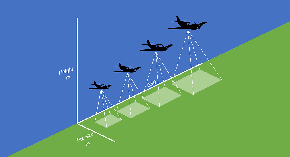
What is the required image resolution? The required pixel resolution, GSD (Ground Sample Distance) is defined by the detail and clarity required in the imagery. The higher the resolution the more detail you will see in the imagery.
What is the required spatial (horizontal) accuracy of the ortho imagery? The spatial accuracy is the measure of the distance, of imagery from its true position and is very much dependent upon the DTM and ground control used in the ortho production.
How many colour bands are required for analysis post capture? Operators will generally be able to offer natural colour RGB (Red, Green, Blue) or four band RGBI (Red, Blue, Green, near infra-red) depending on the sensors they run.
Are there any capture restrictions? Low tide and river flow restrictions affect the capture window. Sun angle at the time of capture will restrict the capture window resulting in capture being very seasonal. Weather is an unknown variable so flexibility on these restrictions will increase the chance of capture within the defined capture window.
When does it need to be captured? Any time limits or specific times of the year?
What systems will be used to view the data? This is important as different systems accept different file formats.
What end products are required? Let the vendor know what end product you require. In post processing operators can provide:
Georeferenced Image frames
Ortho rectified imagery and associated products (attributed tile layout file)
True-ortho imagery - increase building/object verticality by increasing image side and forward overlap capture
Slope and aspect maps for planning purposes
Topographical/feature mapping (including building footprints), extracted/collected from the stereo imagery or from the finished ortho imagery
Change detection mapping/time series mapping
Digital Terrain Model (DTM), Digital elevation Model (DEM) and Digital Surface Model (DSM) outputs
3D mesh model outputs for 3D modelling
Image Dense Matching for high density point cloud outputs – this can also be classified
As mentioned above it is always advisable to reach out to your service provider to help define the specification you need. Please feel free to reach out to Aerial Surveys for help.


Comments