Through the delivery of quality geospatial information we are committed to helping our clients make more informed decisions.
Welcome to Aerial Surveys, the leading aerial surveying and mapping company in New Zealand. Established in 1979 we have been delivering quality airborne surveying services and mapping for over 40 years and have a wealth of experience in our local conditions.
With our commitment to outstanding service and technological excellence it is our vision to be New Zealand's leading and most innovative aerial survey and mapping service provider. We continue to introduce modern, world class technologies to meet the fast evolving needs of clients and achieve this through direct investment and developing partnerships with other operators around the world. In this way we can ensure New Zealand enjoys the benefits of the latest, most efficient and capable technologies available.

LiDAR Data Captured with the Superior Teledyne Optech Galaxy Prime Sensor
World leading technology here in New Zealand
We offer a variety of remote sensing and mapping products and services. Using our experience and innovative thinking we can design solutions suitable for different industries and needs, adding value in the process.
Building strong relationships through excellent customer service, engagement and delivery is how we like to work.

Capturing New Zealand Wide
Customised solutions to meet a wide variety of needs across many industries
Our Focus
Our products and services are used in many different industries as the use of geospatial intelligence grows.
The geospatial data and products we deliver are used in a wide variety of applications and are GIS ready.

Government

Utilities & Resources
Forestry
Mining

Infrastructure
Disaster Response

Environmental

Agriculture &
Farming

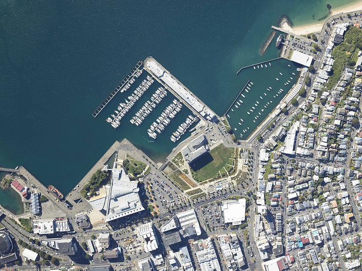
Superior Urban and Rural Imagery
Captured with world class mapping camera technology designed for optimal accuracy, quality and efficiency
Contact Us

Featuring some of the amazing landscapes of New Zealand
Our image library is extensive so if you have a need for more historical imagery or data get in touch.
Extensive Imagery and Data Library
An image library dating back to the 1960s

Simultaneous Near Infrared Imagery Capture
Delivering additional image analysis capability
Looking for an exciting change? View our open positions or submit an application.

Community Support
Auckland Rescue Helicopter Trust Sponsorship
Aerial Surveys has again sponsored the Auckland Rescue Helicopter Trust (ARHT) for the 2022 year.
We are proud to have been a ARHT corporate sponsor for 10 years, helping support this iconic service which was established in 1970 as the world's first ever civilian surf rescue helicopter service.
Over the last 50 years the service has been tasked to over 20,000 thousands missions and is internationally recognized for its pioneering work in saving lives.


